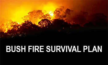
Why we need a plan
Bush Fire Risk Management Plans are an effective instrument for managing risk to human activity and valued community and environmental assets. They are a key component in a multifaceted bush fire management approach for NSW.
Developed using robust data and sophisticated technology and modelling, the plans determine risk factors and develop solutions that best mitigate them.
Feedback from the exhibition of a draft plan for Riverina is currently being assessed. Public feedback will be taken into consideration as the plan is finalised by the Riverina Bush Fire Management Committee before being sent to the Bush Fire Coordinating Committee for review.
Current Bush Fire Risk Management Plan for Riverina
The Bush Fire Risk Management Plan for Riverina was prepared by the current Bush Fire Management Committee.
The Riverina BFRMP was published on 23 May 2018. These plans identify the bush fire risks in Riverina and set out the types of work scheduled to deal with the risk of bush fires.
Bush Fire Risk Management Plans are updated within every five year period, however, the treatments and works set out in the plans are subject to change on a yearly basis due to fire activity, weather and new risk factors. This plan may not have been updated with the latest information.
The Riverina Bush Fire Management Committee is made up of a range of stakeholders from the area including emergency services, land management agencies, local government and local Aboriginal land services, and local community groups. This ensures key community stakeholders have a say on bush fire management activities for the benefit of their communities.
The Riverina Bush Fire Management Committee is made up representatives from the following agencies and organisations:
- NSW Rural Fire Service
- NSW Department of Planning, Housing and Infrastructure (Crown Lands)
- Department of Defence
- Essential Energy
- Transgrid
- NSW Farmers' Association
- Fire and Rescue NSW
- Forestry Corporation of NSW
- City of Wagga Wagga
- Junee Shire Council
- Lockhart Shire Council
- Coolamon Shire Council
- Australian Rail Track Corporation
- UGL Regional Linx
- Riverina Local Land Services
- Wagga Wagga Local Aboriginal Land Council
- Nature Conservation Council of NSW
- NSW National Parks and Wildlife Service
- NSW Police Force
- Transport for NSW
The Riverina Bush Fire Management Committee (BFMC) area spans 1,218,263 hectares (ha). The area covers the Local Government Areas (LGAs) of Wagga Wagga, Coolamon, Junee and Lockhart. The area features the Murrumbidgee River, six National Parks and Nature Reserves comprising 8,249ha (0.68% of BFMC area) and 22 State Forests comprising 13,901ha (1.14% of BFMC area).
The Riverina area has approximately 13% bushland and 85% grassland with the balance being the built environment or water bodies. The average climate in the Riverina BFMC area is temperate, with warm to hot dry summers and cool winters. Rainfall is predominantly in autumn and winter, and the bush fire season generally runs from October to March.
-
 According to the Australian Bureau of Statistics 2021 Census Community Profile there are 32,350 residential dwellings in the Riverina BFMC area with an approximate population of 74,073. The major population centres are Wagga Wagga, Junee, Coolamon, Ganmain, Ardlethan, The Rock and Lockhart. Another 18 urban and village centres are distributed throughout the BFMC area.
 -
 According to the ABS data on the counts of Australian businesses, there were 3,718 businesses in the Riverina BFMC area. The top three industries include Agriculture, Forestry and Fishing; Rental, Hiring and Real Estate Services; and Construction. The Riverina BFMC has seen recent expansion in large-scale solar generation as well as considerable investment in the Wagga Wagga Special Activation Precinct, which includes the Inland Rail project. The Department of Defence has two nationally significant defence installations within the Riverina Zone - the Kapooka Military Area and Royal Australian Air Force (RAAF) Base Wagga.
 -
 The last major bush fire happened in the 2019/20 bush fire season with 9,218 hectares burned.
 -
 There are several valuable community assets across the area along with a number of culturally significant sites and environmentally important sites.


For more information contact your local NSW RFS Fire Control Centre