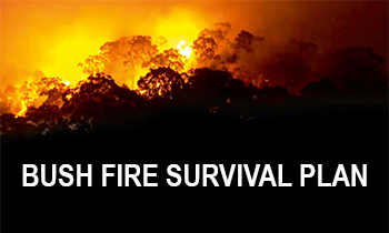
Why we need a plan
Bush Fire Risk Management Plans are an effective instrument for managing risk to human activity and valued community and environmental assets. They are a key component in a multifaceted bush fire management approach for NSW.
We are planning together to manage bush fire risk in the Central and West Darling area by preparing a new five-year plan of strategies and actions.
How will your input be used
The data from the Have Your Say survey responses has been anonymously supplied to your area’s Bush Fire Management Committee. They will assess data collections rather than individual answers, so that they can establish a clearer community sentiment and gain insights from a large sample size.The personal details you submitted will be used to validate your submission and to allow notifications to be sent to you when the status of this BFRMP changes.
Our community
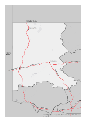
The Central and West Darling BFMC area spans 14,670,100 ha. and features National Parks covering an area of 1,575,247 ha. (10.7% of BFMC area). The Central and West Darling BFMC area includes the Central Darling Shire, a local government area in the Far West region of New South Wales, and the Unincorporated Far West region, which is one of only two areas in NSW that is not part of a local government area. While relatively sparsely populated, the region includes around 18% of NSW’s total land area and includes the towns of Menindee, Tibooburra, Wilcannia and White Cliffs
The BFMC area is predominantly open grass woodlands (approx. 70%) with the balance being bushland & scrub, the built environment or water bodies. A grass or bush fire can happen at any time of the year, but the risk is higher during the warmer months, when grass and scrub are drier.
-
 According to the Australian Bureau of Statistics 2021 Census Community Profile there are 1588 private dwellings in the Central and West Darling BFMC area with an approximate population of 2741.
 -
 According to the ABS data on the counts of Australian businesses, there were 259 businesses in the Central and West Darling BFMC. The principal economic activities within the BFMC area include pastoral, horticultural, agricultural, mining (opals) and tourism. Rural grazing properties represent the largest land use with major horticultural and agricultural production centred on Menindee. The main industries of employment are Sheep Farming (Specialised), Accommodation and Sheep-Beef Cattle farming.
 -
 The last major bush fires happened in the 2012/2013 Bush fire Season with numerous large fires.
 -
 There are several valuable community assets across the area along with a number of culturally significant sites and environmentally important sites including the Menindee Lakes, the Kinchega, Paroo-Darling and Mutawintji National Parks, and the Darling River system.
Current Bush Fire Risk Management Plan for Central and West Darling
The Central Darling BFRMP and West Darling BFRMP both published on 8th June 2011.
These plans identify the bush fire risks in Central and West Darling and sets out the types of work scheduled to deal with the risk of bush fires.
BFRMPs are updated within every five-year period, however, the treatments and works set out in the plans are subject to change on a yearly basis due to fire activity, weather and new risk factors. This plan may not have been updated with the latest treatment and works plans/information.
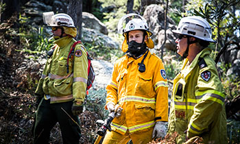
Central and West Darling BFMC is made up of a range of stakeholders from the area including emergency services, land management agencies, local government and local aboriginal land services, and local community groups. This ensures key community stakeholders have a say on bush fire management activities for the benefit of their communities.
The Central and West Darling BFMC is made up of the following representatives:
- NSW Rural Fire Service
- Central Darling Shire Council
- Fire and Rescue NSW
- NSW Police Force
- Essential Energy
- Local Land Services
- National Parks and Wildlife Service
- Department of Industry (Crown Lands)
- Nature Conservation Council of New South Wales
- NSW Farmers Association
- Local Aboriginal Land Councils
- Transport for NSW
- Pastoralists Association of West Darling

For more information contact your local NSW RFS Fire Control Centre