Why we need a plan
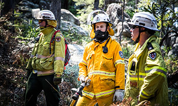
Bush Fire Risk Management Plans are an effective instrument for managing risk to human activity and valued community and environmental assets. They are a key component in a multifaceted bush fire management approach for NSW.
We are planning together to manage bush fire risk in the Barwon/Darling area by preparing a new five-year plan of strategies and actions.
How will your input be used
The data from the Have Your Say survey responses has been anonymously supplied to your area’s Bush Fire Management Committee. They will assess data collections rather than individual answers, so that they can establish a clearer community sentiment and gain insights from a large sample size.The personal details you submitted will be used to validate your submission and to allow notifications to be sent to you when the status of this BFRMP changes.
Our community
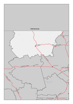
The Barwon/Darling BFMC area spans 6,086,596 Hectares (ha). The area covers the Bourke and Brewarrina Local Government Areas (LGA) and features National Parks covering an area of 393,437 ha (6.4% of BFMC area).
The Barwon/Darling BFMC area is predominantly semi-arid shrub & woodlands (approx. 80%), with the balance being native grasslands, the built environment or water bodies. A scrub or grass fire can happen at any time of the year, but the risk is higher during the warmer months, when grass and scrub are drier.
-
 According to the Australian Bureau of Statistics 2021 Census Community Profile there are 2,035 residential dwellings in the Barwon/Darling BFMC area with an approximate population of 3,696.
 -
 According to the ABS data on the counts of Australian businesses, there were 312 businesses in the Barwon/Darling BFMC. The top three included Agriculture, Forestry and Fishing, Construction, and Rental, Hiring and Real Estate Services accounting for approximately 61.8% of businesses in the Barwon/Darling BFMC area.
 -
 The last major bush fires happened in the 2023/2024 Bushfire Season with 27,000 ha burnt.
 -
 There are several valuable community assets across the area along with a number of culturally significant sites and environmentally important sites. The Barwon–Darling River and its floodplain are home to some of Australia's most iconic native plants and animals, and provides breeding habitat for waterbirds, including the threatened, blue-billed duck and freckled duck. The Barwon–Darling River catchment is the land of many Aboriginal people, including the Barkindji, Murrawarri, Ngemba and Ngiyampaa. A significant and valuable example of one of the oldest human-made structures on earth is at Brewarrina on the Barwon River, where Aboriginal people built extensive and intricate stone fish traps (Baiame's Ngunnh)
Current Bush Fire Risk Management Plan for Barwon/Darling
The Barwon/Darling BFRMP published on 8th June 2021.
These plans identify the bush fire risks in Barwon/Darling and sets out the types of work scheduled to deal with the risk of bush fires.
BFRMPs are updated within every five-year period, however, the treatments and works set out in the plans are subject to change on a yearly basis due to fire activity, weather and new risk factors. This plan may not have been updated with the latest treatment and works plans/information
Barwon/Darling BFMC is made up of a range of stakeholders from the area including emergency services, land management agencies, local government and local aboriginal land services, and local community groups. This ensures key community stakeholders have a say on bush fire management activities for the benefit of their communities.
The Barwon Darling BFMC is made up of the following representatives:
- NSW Rural Fire Service
- Brewarrina Shire Council
- Bourke Shire Council
- Fire and Rescue NSW
- NSW Police Force
- Essential Energy
- Local Land Services
- National Parks and Wildlife Service
- Department of Industry (Crown Lands)
- Nature Conservation Council of New South Wales
- NSW Farmers Association
- Local Aboriginal Land Councils
- Transport for NSW


For more information contact your local NSW RFS Fire Control Centre