Climate outlook for May to August 2021
Published Date: 30 Apr 2021
Summary
The Bureau of Meteorology has released the climate forecast from May to August 2021.
Climate outlook overview
Direct link to the Bureau Climate update
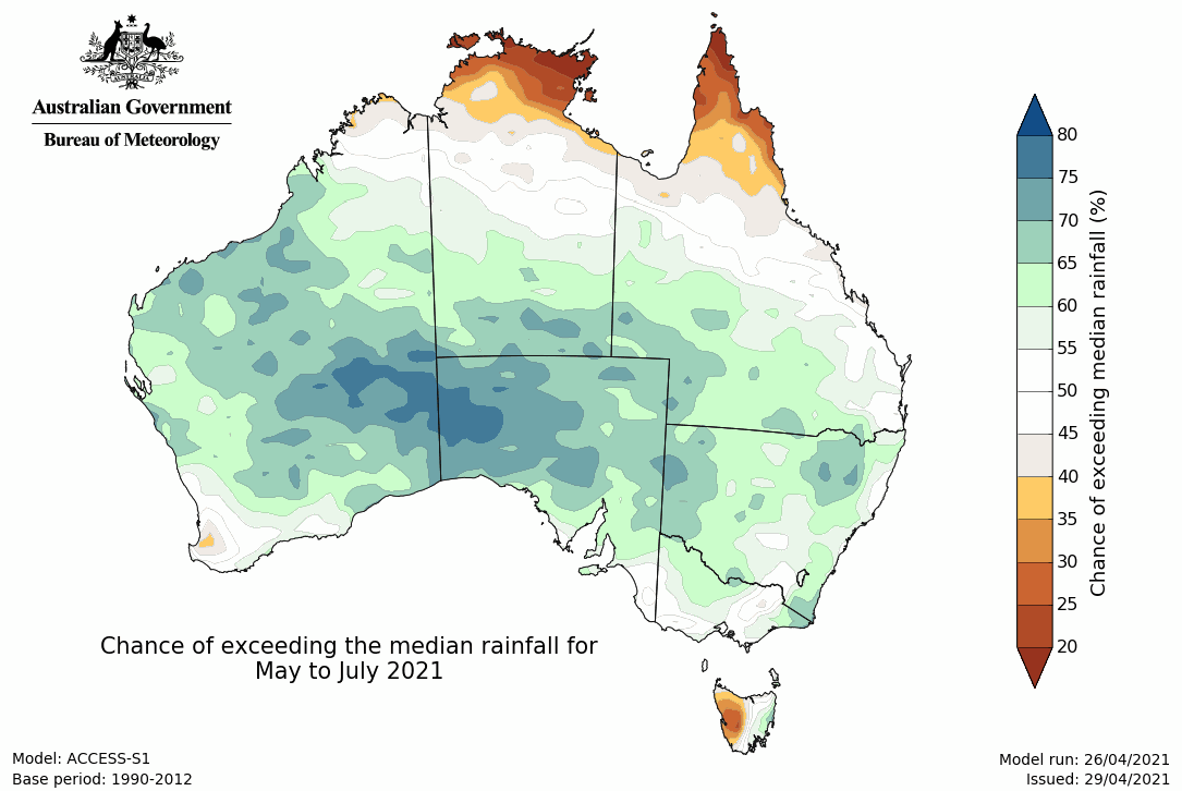
- May to July rainfall likely to be above average for the southern half of the mainland, but areas in the south-west and south-east have roughly equal chances of above or below average rainfall. Western Tasmania and northern tropics are likely to have a drier May to July.
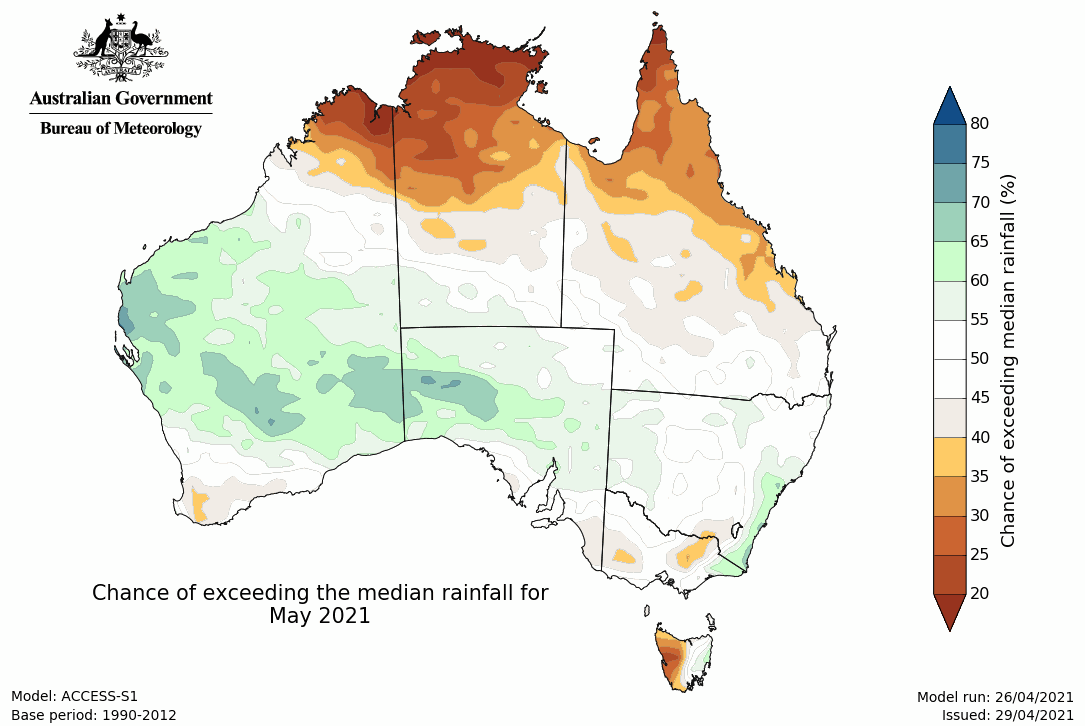
- May is likely to be drier than average in northern Australia and western Tasmania, while a wetter than average May is likely for central and south-east WA, western SA, and south-east NSW.
- Maximum temperatures for May to July are likely to be above average for most parts of Australia.
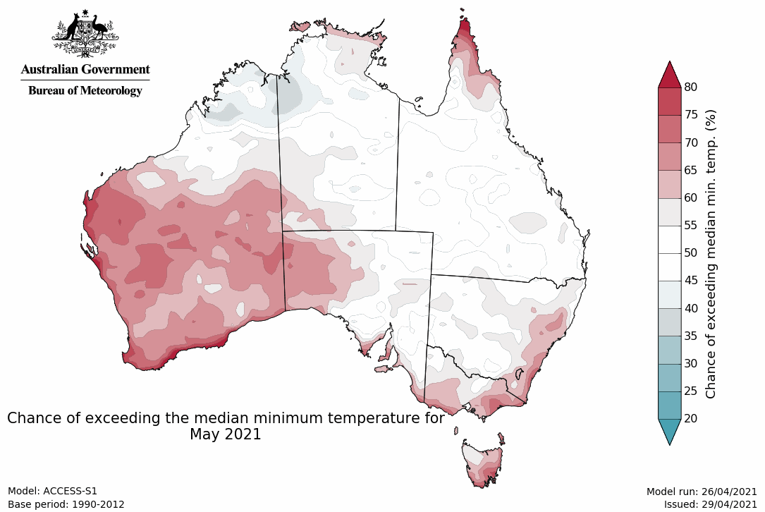
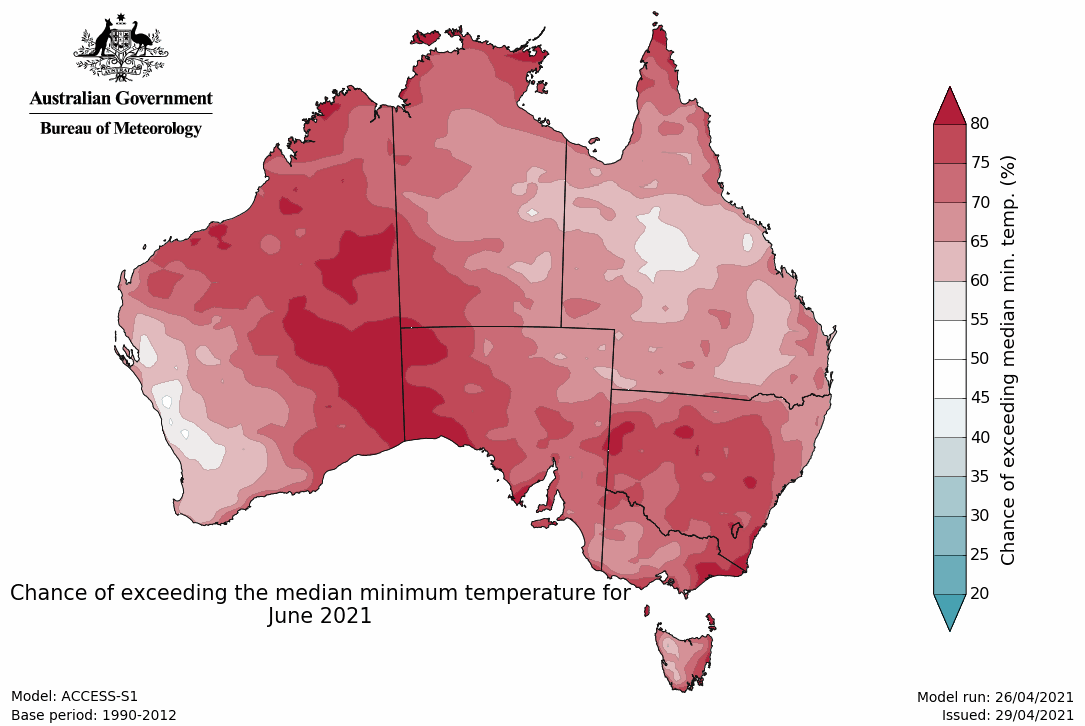
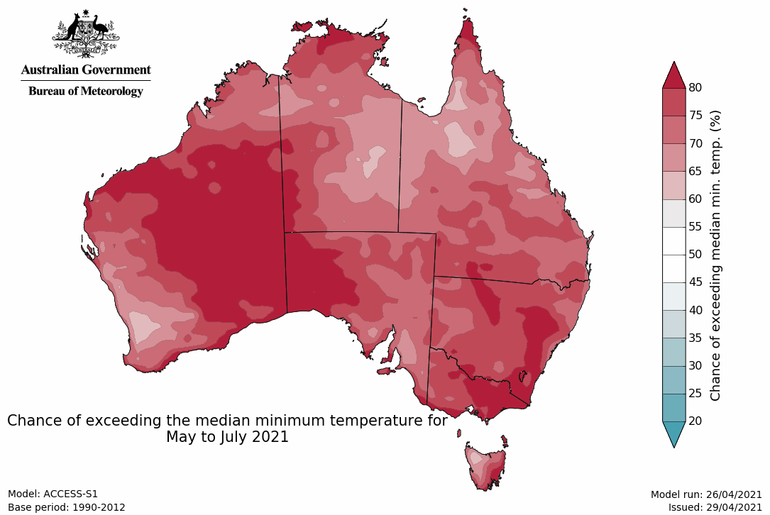
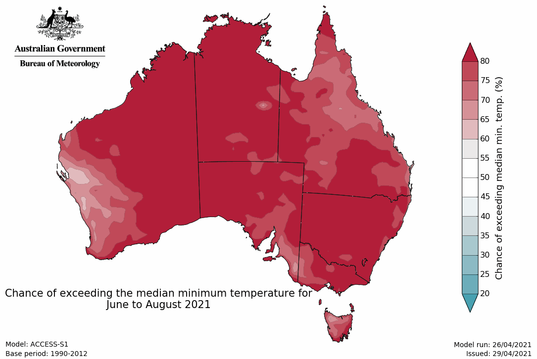
- Similarly, minimum temperatures for May to July are likely to be above average Australia wide.
- The El Niño–Southern Oscillation is neutral, as are most other climate drivers.
Above average May to July rainfall for much of southern mainland Australia
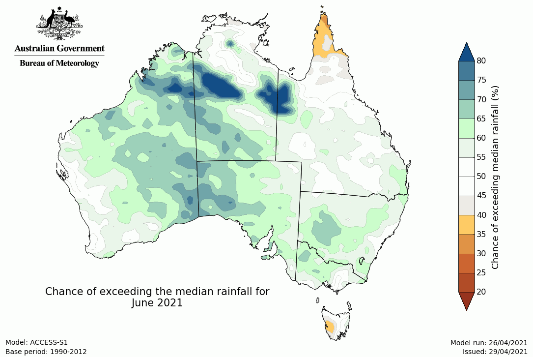
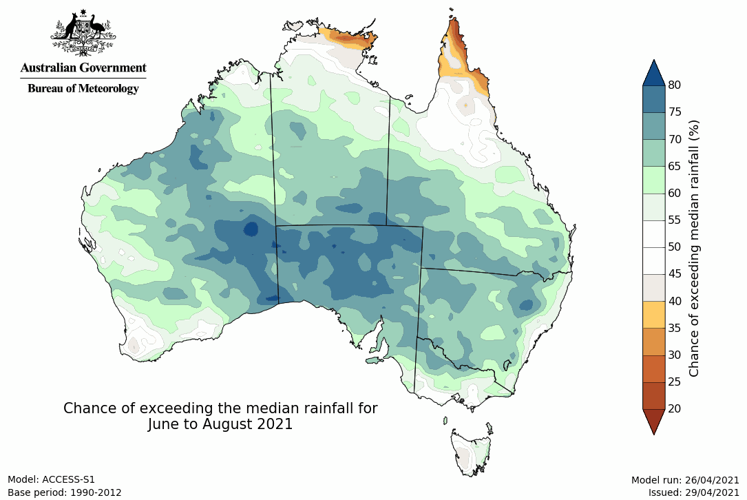
- Rainfall for May to July is likely to be above average for the southern half of the mainland (chance of exceeding median is greater than 60%), but south-west WA, south-east SA, south-east Queensland, and most of eastern NSW and Victoria have roughly equal chances of above or below average rainfall. Western Tasmania and northern tropics are likely to have a drier May to July (chance of exceeding median is less than 40%).
- May is likely to be drier than average in northern Australia and western Tasmania, while a wetter than average May is likely for central and south-east WA, western SA, and south-east NSW.
- It should be noted that May marks the beginning of the northern Australian dry season. This means tropical northern Australia typically has very low rainfall totals, and only a small amount of rainfall is needed to exceed the median.
Rainfall maps
Warmer than average May to July days for most areas
- Maximum temperatures for May to July are likely to be above average for most parts of Australia (greater than 60% chance), with northern WA, the northern NT and northern Cape York Peninsula very likely to be warmer (greater than 80% chance). Central and south-east WA, and western SA have roughly equal chances of being warmer or cooler than average (chance of exceeding the median is close to 50%).
- May days are likely to be warmer than average for most areas (chances of being warmer than median are greater than 60%), except the eastern Top End of the NT and much of northern Queensland where there are roughly equal chances of warmer or cooler days (chance of exceeding the median is close to 50%).
- Minimum temperatures for May to July are likely to be warmer than average nationwide (greater than 60% chance), with eastern WA, south-east NSW, eastern Victoria, and south-east Tasmania very likely to have warmer than average nights (greater than 80% chance).
- May nights are likely to be warmer than average for southern WA, western SA, south-east SA, eastern NSW, southern Victoria, and Tasmania, with other regions mostly having roughly equal chances of being warmer or cooler than average. Some small areas are likely to have cooler than average nights (chances of exceeding the median is less than 40%).
Maximum temperature maps
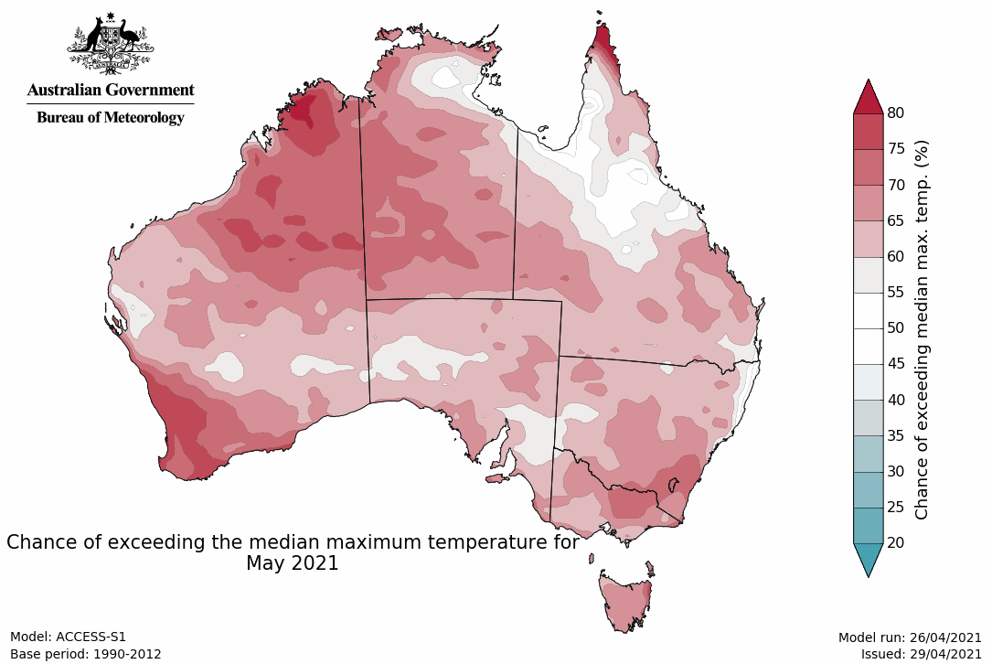
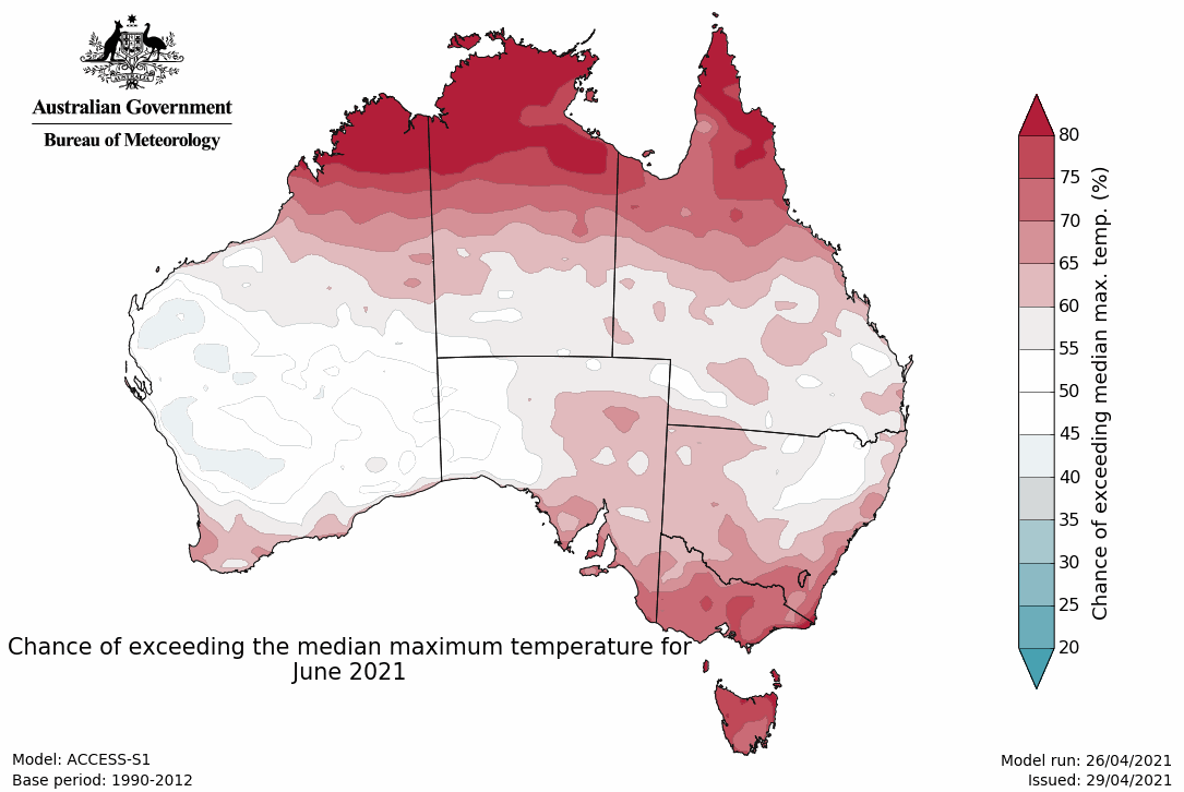
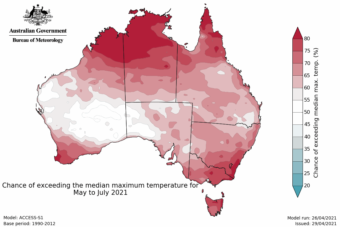
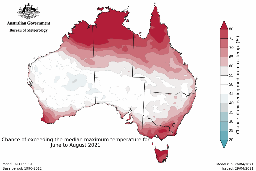
Minimum temperature maps
Climate influences
- The tropical Pacific remains neutral with respect to the El Niño–Southern Oscillation (ENSO). Model outlooks predict neutral ENSO conditions through to the start of spring. Neutral ENSO has little influence on Australian climate and means other, more localised climate drivers may have more influence on Australia's weather and climate.
- The Indian Ocean Dipole (IOD) is currently neutral. Outlooks indicate the IOD is most likely to remain neutral for the remainder of autumn and early winter, although it briefly touches on positive thresholds near the end of autumn. However, it should be noted that model accuracy is low at this time of the year, so the current outlooks should be viewed with caution.
- While the IOD is most likely to remain neutral, above average Indian Ocean sea surface temperature patterns outside of the IOD region may be providing more conducive conditions for rainfall across some parts of Australia.
- The Southern Annular Mode (SAM) index is forecast to remain neutral for the coming fortnight. The SAM mostly has little influence on Australian rainfall during autumn.
- The Madden–Julian Oscillation (MJO) is currently over tropical America. It is forecast to move eastwards towards Africa during the coming fortnight. At this time of the year, the MJO influence is shifting to the northern hemisphere, and therefore begins to have less influence on northern Australia. When the MJO is active over the African region, convection is typically suppressed over far northern Australia and the tropical regions to the north of Australia.
- Australia's temperature and rainfall variability are also influenced by global warming caused by human activities. Australia's climate has warmed by around 1.44 °C for the 1910–2019 period, while southern Australia has seen a reduction of 10–20% in cool season (April–October) rainfall in recent decades. With most climate drivers neutral, it is possible that recent trends in Australia's climate may be more apparent in forecast patterns, for example, warmer than average May to July days for most.
- The Bureau's climate model uses the physics of our atmosphere, oceans, ice, and land surface combined with millions of observations from satellites and on land and sea. As a result, it incorporates the influence of climate change and natural climate drivers like ENSO, IOD, the MJO, and SAM in its outlooks.


