Climate outlook for January to April 2021
Published Date: 28 Jan 2021
Summary
The Bureau of Meteorology has released the climate forecast from February to May 2021.
Climate outlook overview
Direct link to the Bureau Climate update
Issued 28-1-2021
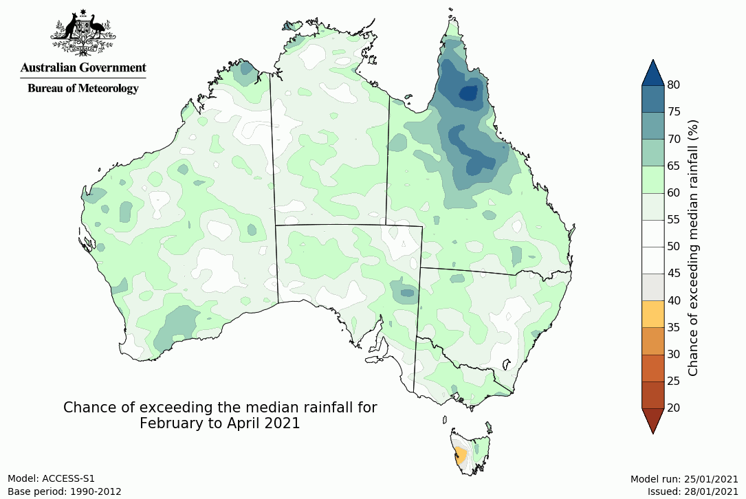
- February to April rainfall is likely to be above average for northeast Queensland.
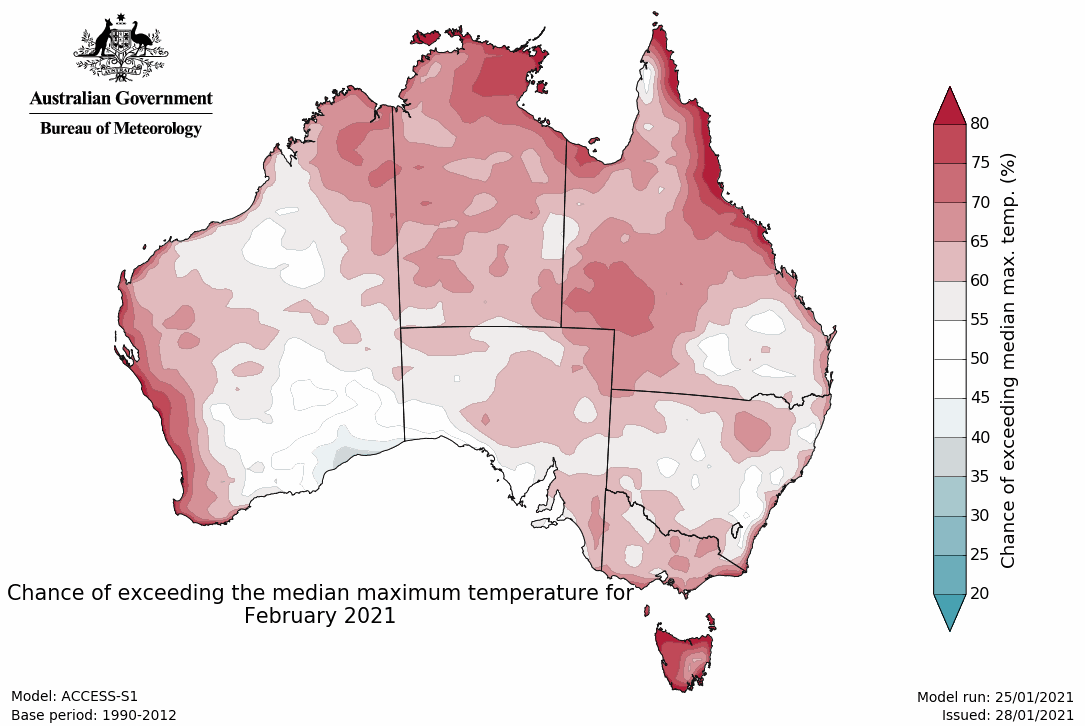
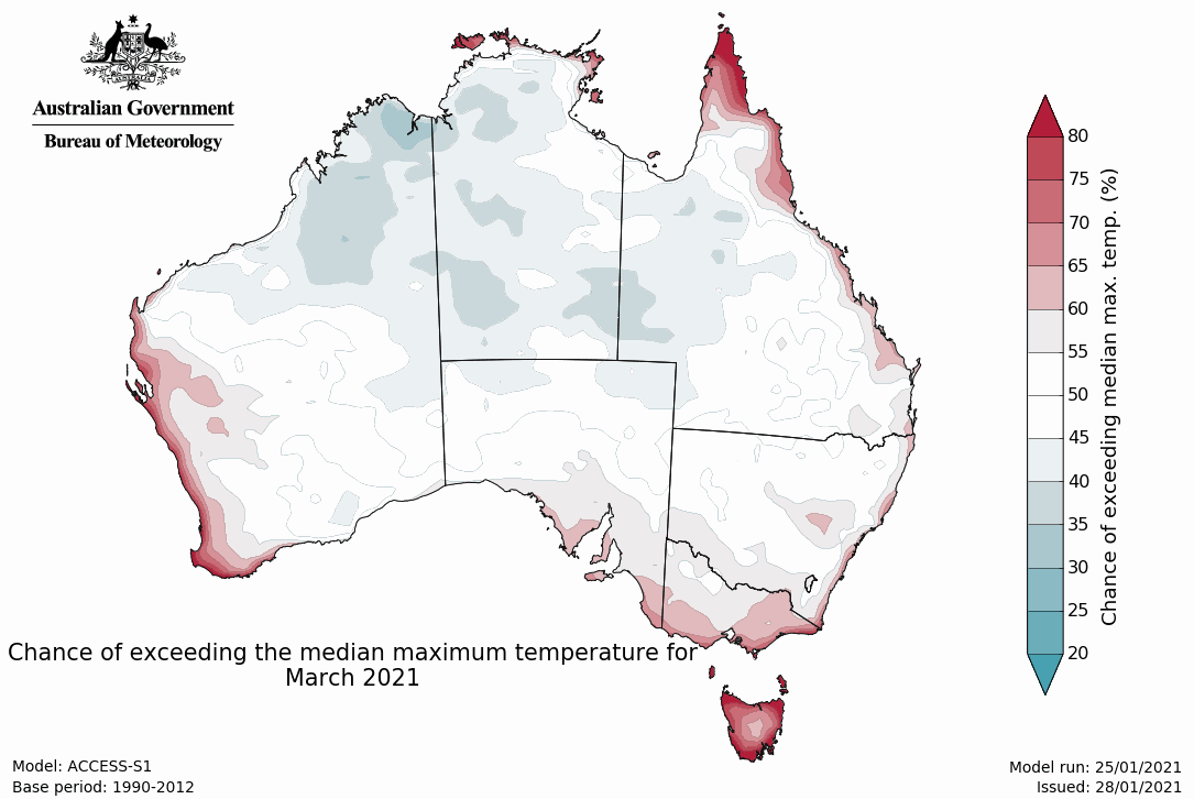
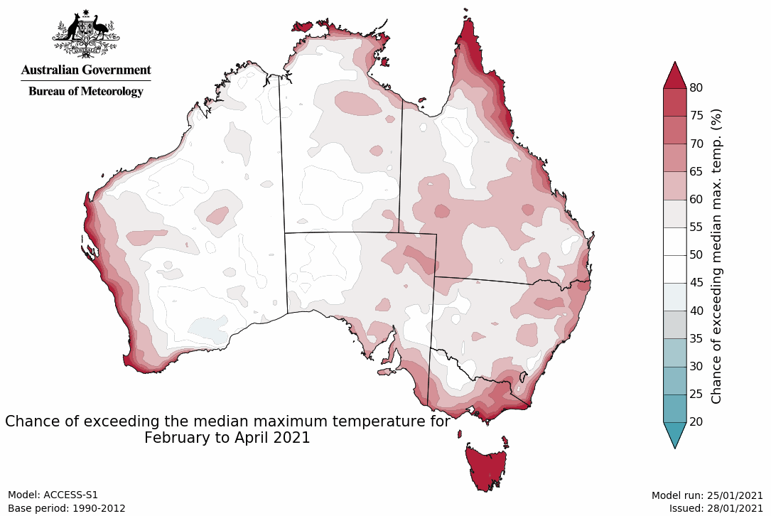
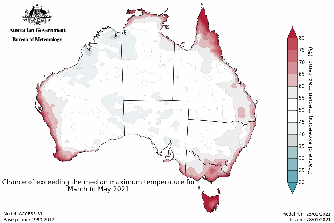
- temperatures for February to April are likely to be warmer than average over Tasmania and around much of the Australian coastline.
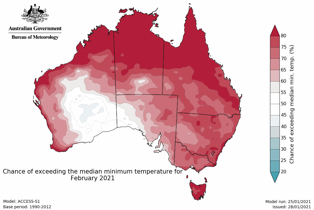
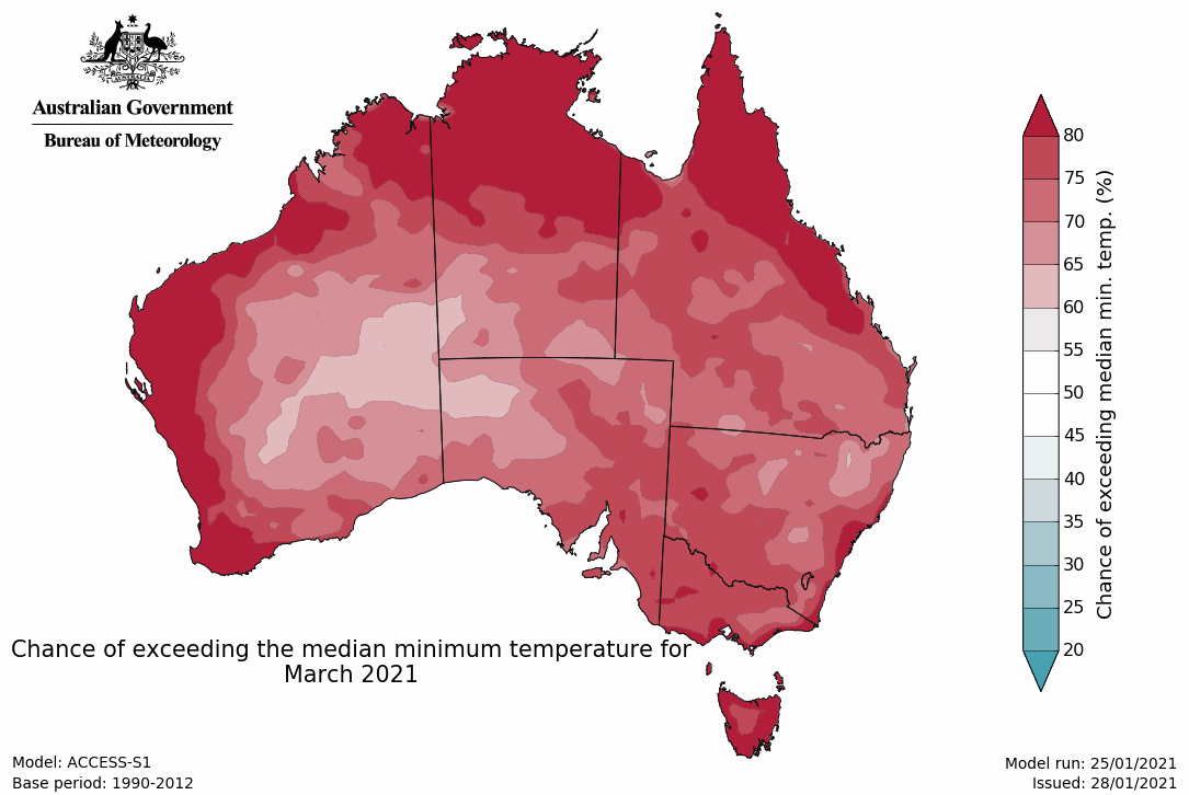
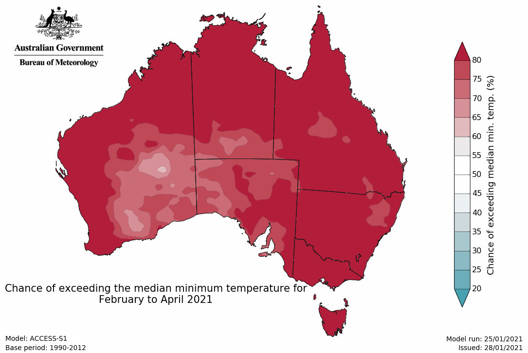
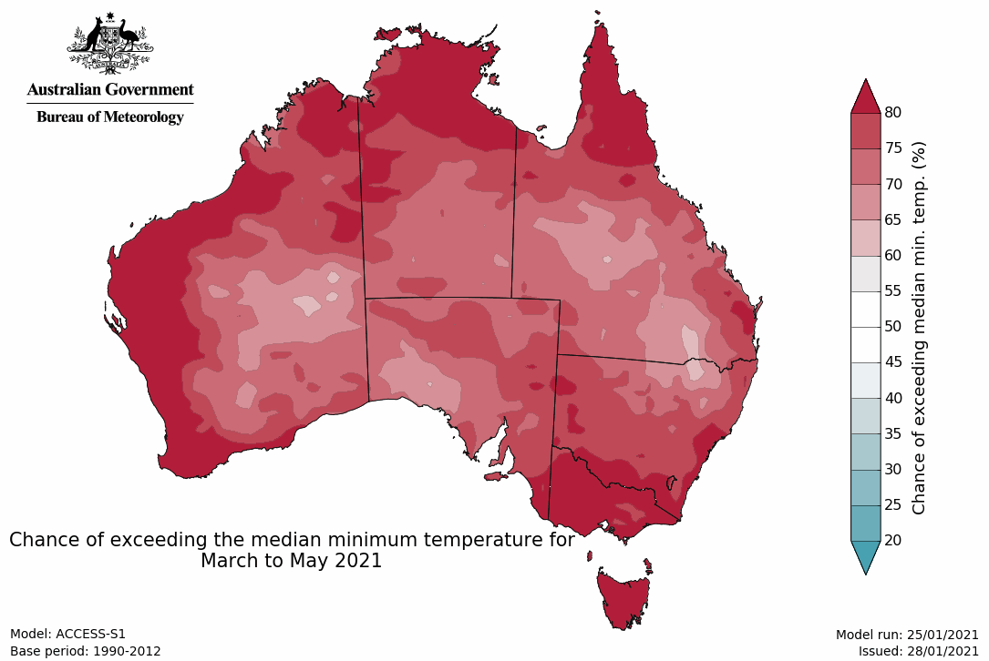
- Overnight temperatures for February to April are very likely to be above average across nearly all of Australia.
- La Niña remains active in the tropical Pacific. The event has likely reached its peak strength but is expected to continue to influence Australian rainfall patterns until at least early autumn.
February–April likely wetter than average for Australia, particularly Queensland
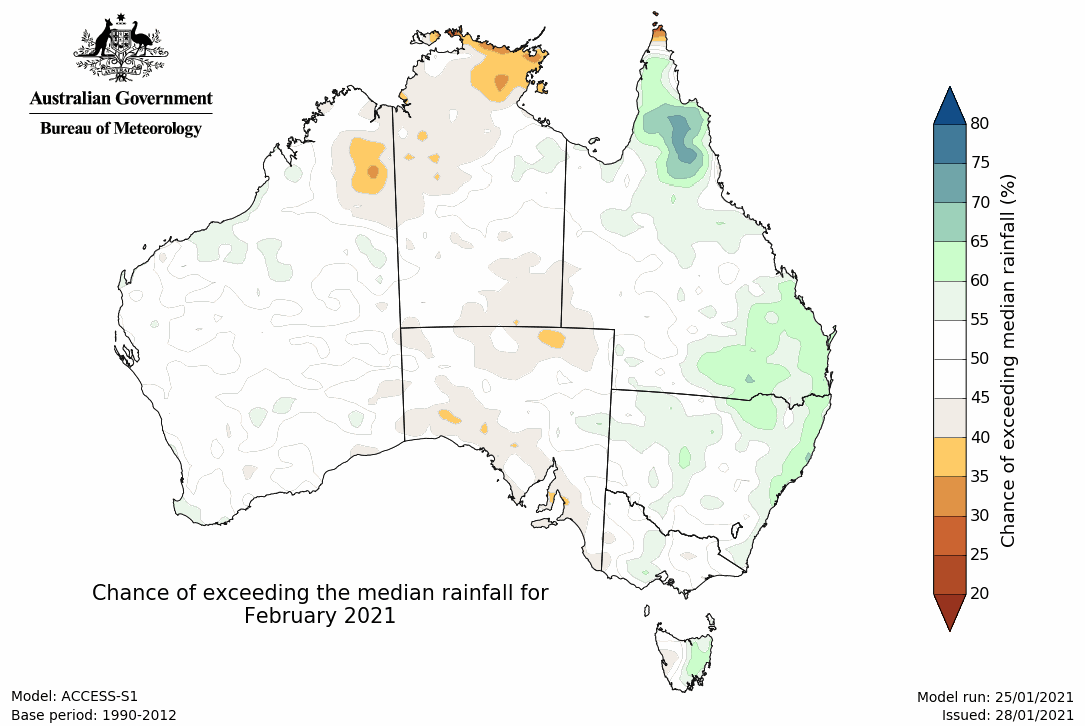
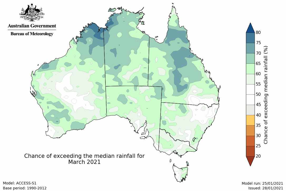
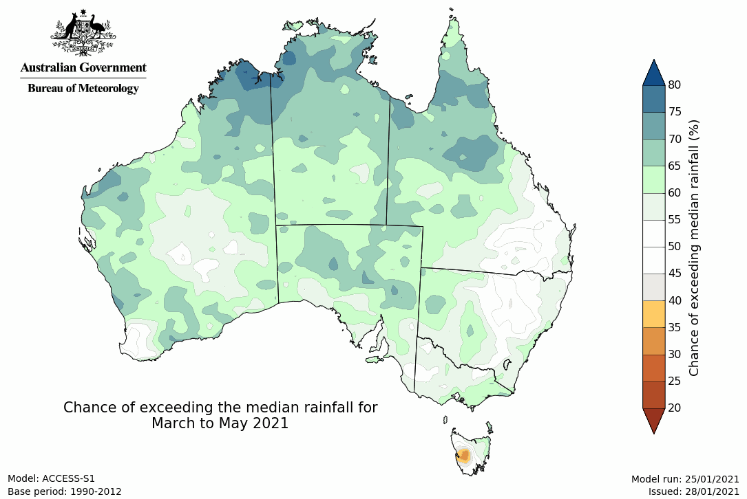
- February to April is likely to be wetter than average across much of the mainland, with strongest chances of above average rainfall (greater than 70%) in northern .
- February is likely to be wetter than average along the Qld and NSW coasts (greater than 60% chance). Elsewhere there is no significant shift towards a wetter or drier than average month.
- Rainfall for the fortnight 1 to 14 February is likely to be wetter than average for parts of the Kimberley and Cape York Peninsula (greater than 60% chance) while drier than average conditions are more likely over NT, SA and interior parts of Qld and NSW (greater than 60% chance).
- While the outlooks indicate near- to above-average conditions for southern Australia, this is their drier season, so rainfall (even if above average) is not likely to be sufficient to relieve long-term rainfall deficits.
Warmer days likely in most coastal regions for February–April; warmer nights almost Australia-wide
- Mean maximum temperatures for February to April are very likely to be higher than the long-term average across Tasmania (greater than 80% chance) as well as most of the Australian coastline. The outlook for February indicates a similar pattern though there is a greater area that is more likely to experience above-average temperatures, particularly over northern Australia.
- Mean minimum temperatures for February to April are very likely (greater than 80% chance) to be above the long-term average across most of Australia, although chances are slightly weaker (60 to 70% chance) over the WA interior and adjacent SA and NT. The outlook for February is similar though chances of warmer or cooler conditions for south-east WA and western SA are close to equal.
- Mean maximum temperatures for the fortnight 1 to 14 February are likely (greater than 65% chance) to be above the long-term average for NT, Qld, northern NSW and western WA (greater than 65% chance). Cooler than average temperatures are likely for most of the remainder of the mainland, especially south-east WA, north-west Vic and south-west NSW (greater than 65% chance). A similar outlook exists for mean minimum temperatures.
Climate influences
- La Niña remains active but is likely past its peak.
- Model outlooks suggest a return to neutral conditions (neither El Niño nor La Niña) is likely by late summer or early autumn. However, the influence on Australian rainfall patterns is likely to continue until at least early autumn. La Niña typically increases the likelihood of above-average rainfall across eastern and northern Australia during summer and early autumn.
- The Southern Annular Mode (SAM) is negative but is expected to return to neutral values and remain so during February.
- The Madden-Julian Oscillation (MJO) is currently in the western Pacific and is moderate in strength. Climate models generally agree it will remain in the western Pacific over the next fortnight. At this time of the year, a MJO in this region is typically associated with above-average rainfall and increased tropical low activity in the Australian region.
- Sea surface temperatures (SSTs) are warmer than average around much of Australia, particularly off the western coast. These warm SSTs are also likely to be contributing to above-average rainfall for parts of the country.
- Australia's temperature and rainfall variability are also influenced by global warming caused by human activities. Australia's climate has warmed by around 1.44 °C ± 0.24 °C over the period 1910-2019, while recent decades have seen increased rainfall during the northern wet season (October–April), with more high intensity and short duration rainfall events. See State of the Climate for more details.
- The Bureau's climate model uses the physics of our atmosphere, oceans, ice, and land surface combined with millions of observations from satellites and on land and sea. As a result, it incorporates the influence of climate change and natural climate drivers like ENSO, IOD, the MJO, and SAM in its outlooks.


