Climate outlook for March to June 2021
Published Date: 28 Feb 2021
Summary
The Bureau of Meteorology has released the climate forecast from March to June 2021.
Climate outlook overview
Direct link to the Bureau Climate update
Issued 25-2-2021
- March to May (autumn) rainfall is likely to be wetter than average for large parts of eastern Australia.
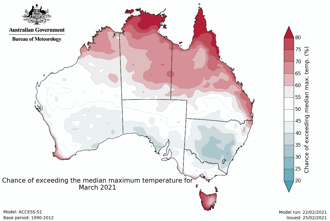
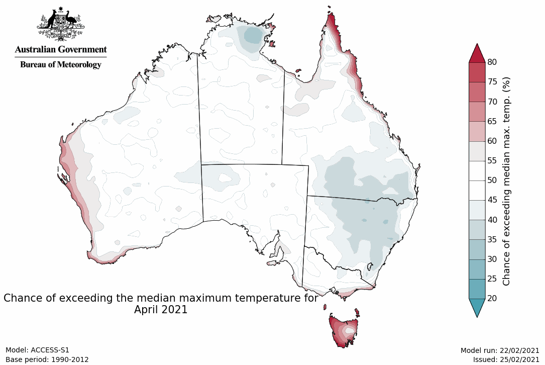
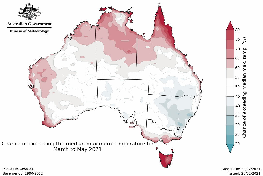
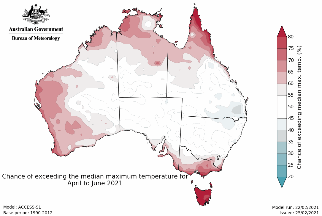
- Maximum temperatures for autumn are likely to be warmer than average for parts of northern Australia, western WA and the far south-east of Australia. Conversely, days are likely to be cooler than average for parts of NSW.
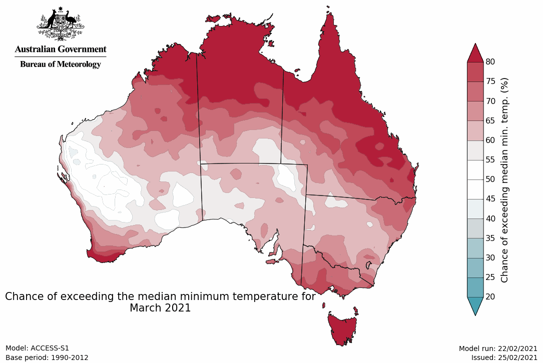
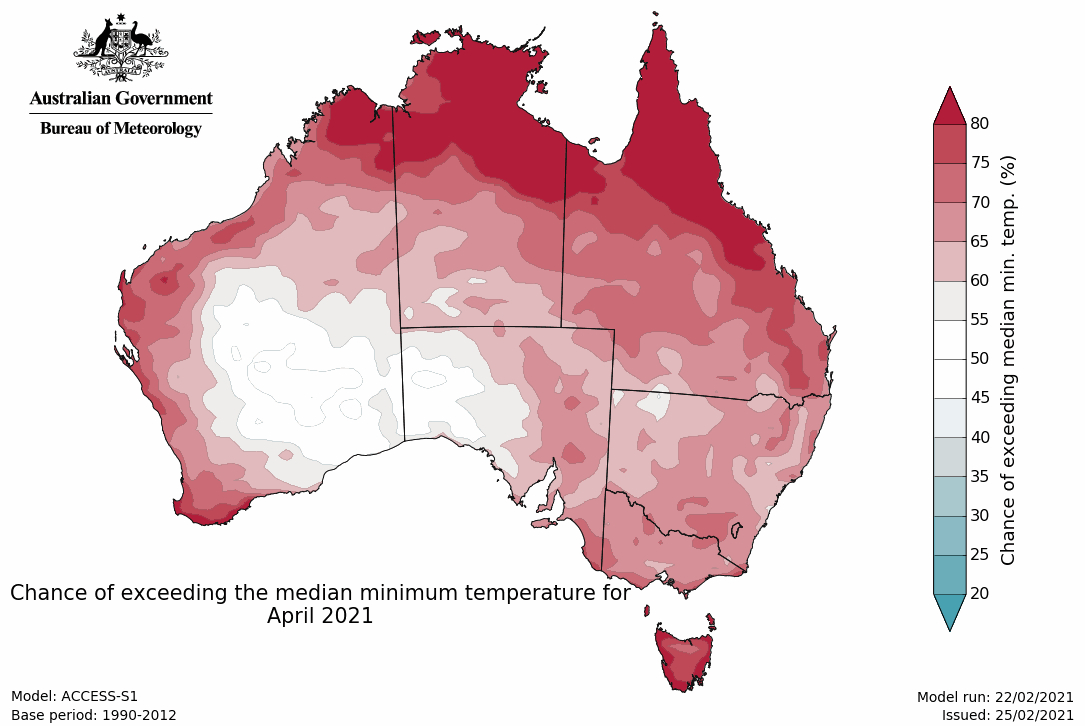
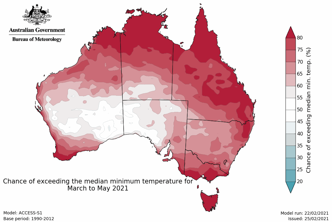
- Minimum temperatures for autumn are likely to be warmer than average for most of Australia, except for parts of the south and west.
- The current La Niña is forecast to end during autumn. La Niña typically increases the likelihood of above average rainfall across eastern Australia during early autumn.
Wetter autumn likely for much of eastern Australia
- Autumn is likely to be wetter than average across Arnhem Land in the NT, southern and eastern Queensland, most of NSW, eastern SA, and eastern Tasmania. Chances greater than 70% are generally confined to small pockets of southern Queensland and north-east NSW.
- However, most of WA, the NT, Victoria and western parts of Queensland, SA and Tasmania show no significant shift towards a wetter or drier three months.
- For March, the pattern for wetter conditions is similar to autumn, but includes Victoria, western SA, and northern Tasmania.
- The fortnight of 1 to 14 March is likely to be drier than average (chance of exceeding median is less than 40%) in the northern Kimberley and Top End of the NT, while the southern half of the country extending up through inland eastern Queensland is likely to have a wetter fortnight.
Rainfall maps
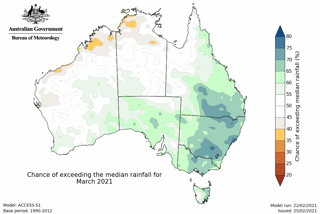
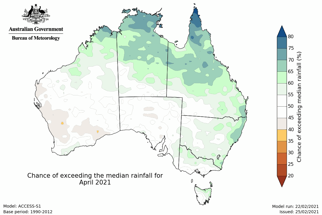
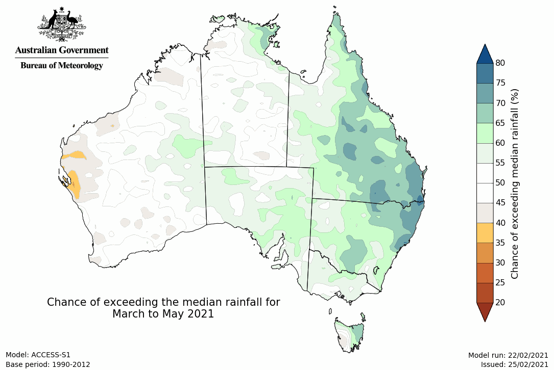
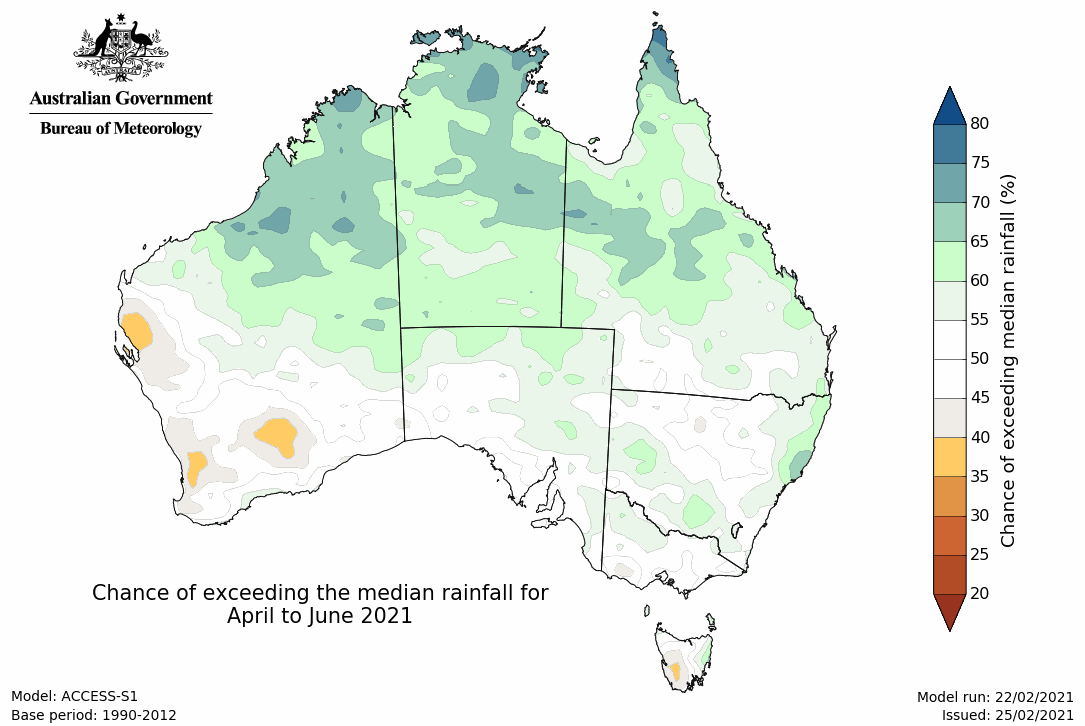
Warmer autumn days likely for much of the north, west and far southeast Australia; warmer nights across north, east and southwest Australia
- For the fortnight of 1 to 14 March, maximum temperatures are likely to be warmer than average across the northern tropics and extending down eastern Queensland (most areas have a greater than 70% chance). Much of the western Pilbara and parts of the inland east are likely to be cooler than average.
- Minimum temperatures for the fortnight 1 to 14 March are likely to be warmer than average across most of the NT, northern and eastern Queensland, southern Victoria, Tasmania, and eastern and southern WA. Chances are greater than 80% in the eastern Top End and Cape York Peninsula. The western Pilbara is likely to have cooler nights.
- Mean maximum temperatures for autumn (March to May) are likely to be higher than average for much of the northern tropics, western WA extending down the south-west WA coastline, southern Victoria, and Tasmania (greater than 60% chance). Cooler than average maximum temperatures are likely (greater than 60% chance) for parts of NSW.
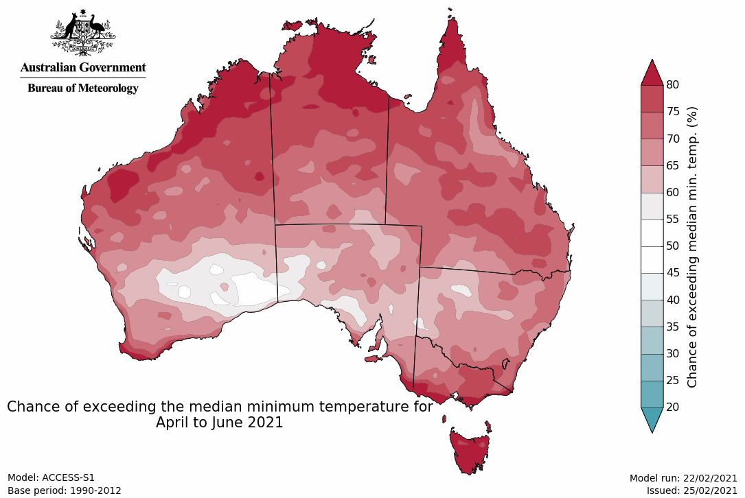
- Autumn minimum temperatures are likely to be higher than average across most of Australia except for parts of southern WA and western and central SA. Chances of warmer nights are greater than 80% for the northern tropics, eastern Queensland, southern Victoria, and Tasmania.
Maximum temperature maps
Minimum temperature maps
Climate influences
- La Niña remains active but is past its peak. Model outlooks indicate the El Niño–Southern Oscillation (ENSO) will return to neutral (neither El Niño nor La Niña) during autumn. La Niña typically increases the likelihood of above average rainfall across eastern Australia during early autumn. A neutral ENSO has little influence on Australian climate.
- The Southern Annular Mode (SAM) index is neutral and expected to remain close to neutral for the coming fortnight. When the SAM index is neutral, it has little influence on Australian climate.
- The Madden–Julian Oscillation (MJO) is currently weak. It is unlikely to have a significant influence on northern Australia's weather this week.
- Sea surface temperatures (SSTs) are warmer than average around much of the north, west and southeast of Australia. These warm SSTs are likely to be contributing to above-average temperature outlooks for adjacent land areas.
- Australia's temperature and rainfall variability are also influenced by global warming caused by human activities. Australia's climate has warmed by around 1.44 °C since 1910, while recent decades have seen increased rainfall during the northern wet season (October–April), with more high intensity and short duration rainfall events. See State of the Climate for more details.
- The Bureau's climate model uses the physics of our atmosphere, oceans, ice, and land surface combined with millions of observations from satellites and on land and sea. As a result, it incorporates the influence of climate change and natural climate drivers like ENSO, IOD, the MJO, and SAM in its outlooks.


