Climate outlook for April to July 2021
Published Date: 01 Apr 2021
Summary
The Bureau of Meteorology has released the climate forecast from April to July 2021.
Climate outlook overview
Direct link to the Bureau Climate update
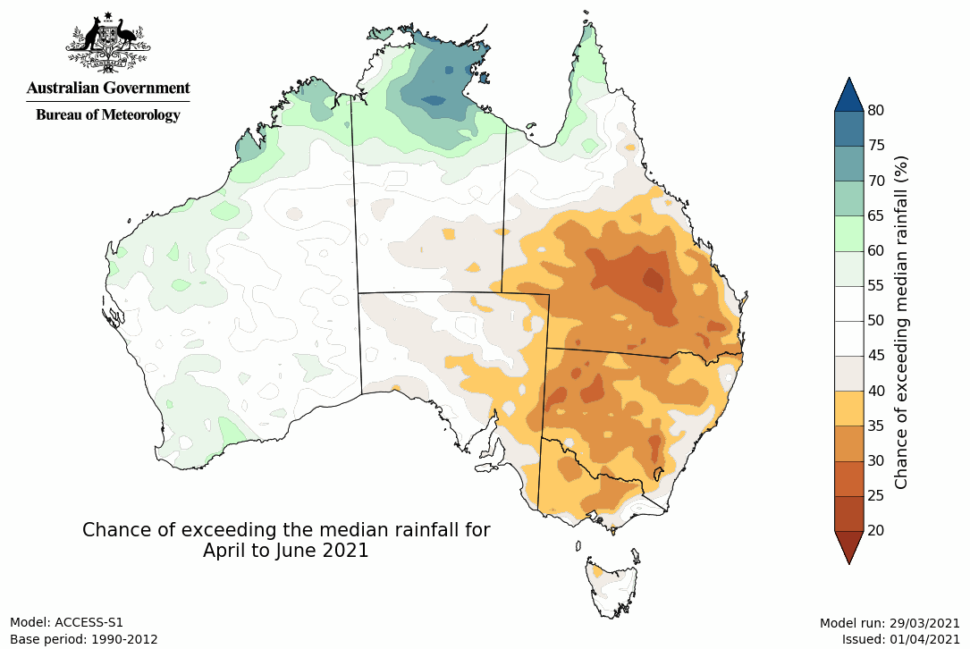
- April to June rainfall is likely to be above average for the far north of Australia, however this signal is mostly from April. The three months are also likely to be drier than average for large parts of the eastern mainland of Australia.
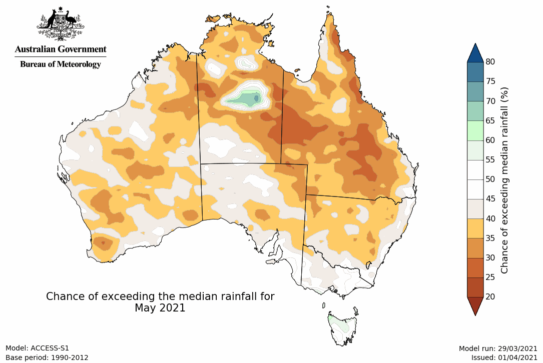
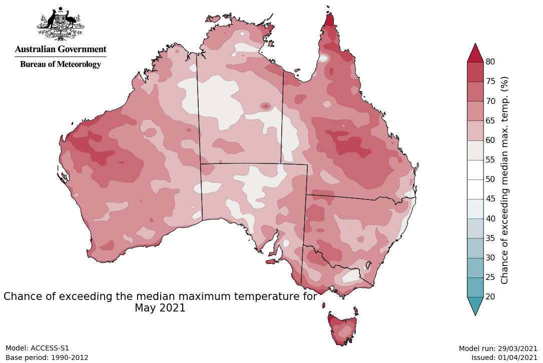
- In May, a broader drier than average pattern is present, with a drier month likely for much of the mainland, except the south-east.
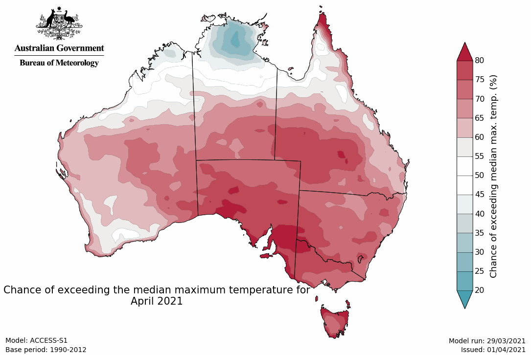
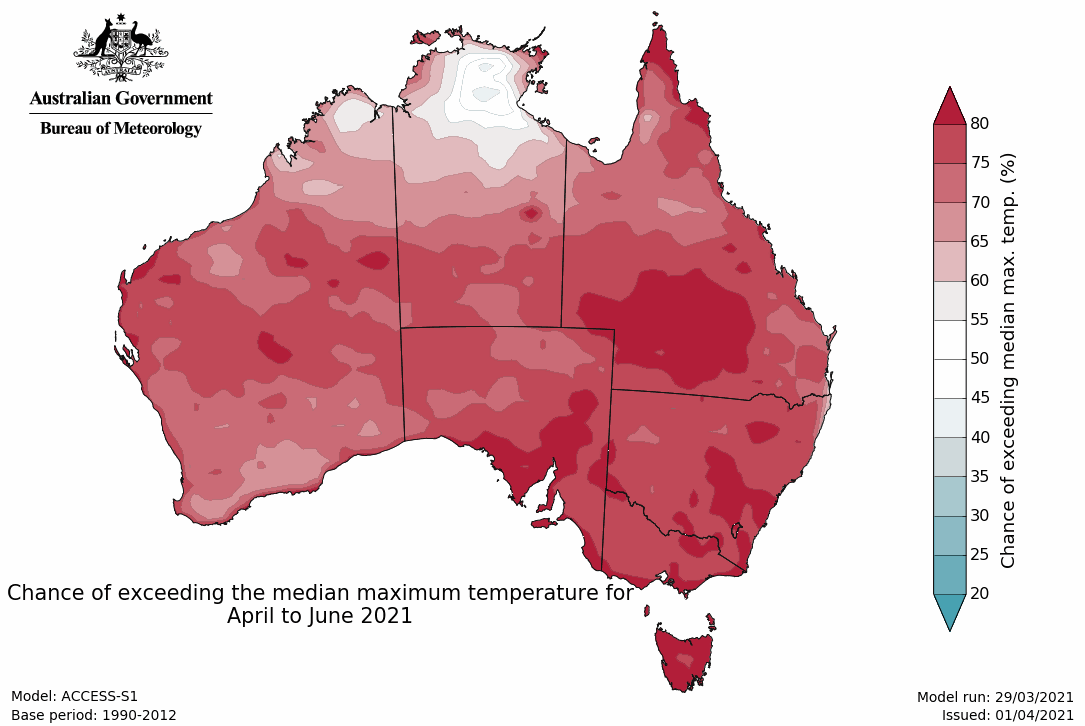
- Maximum temperatures for April to June are likely to be warmer than average for most of Australia, except the NT's Top End.
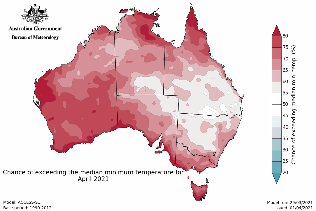
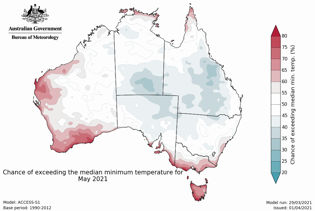
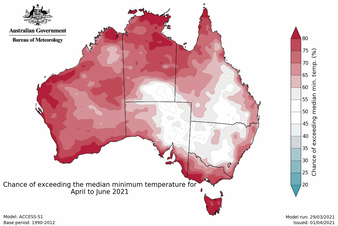
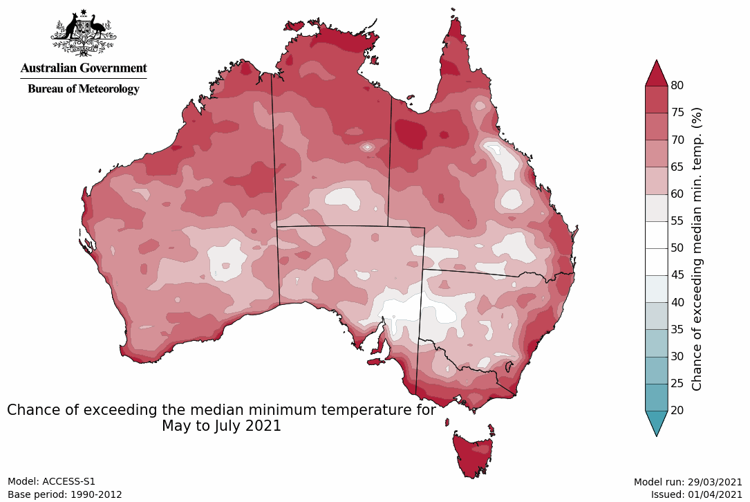
- Minimum temperatures for April to June are likely to be warmer than average for much of Australia, except broad areas of the inland east and into central Australia.
- La Niña has faded, with the El Niño–Southern Oscillation now in a neutral phase.
April likely to be wetter than average for parts of northern and south-western Australia, but drier for parts of the east
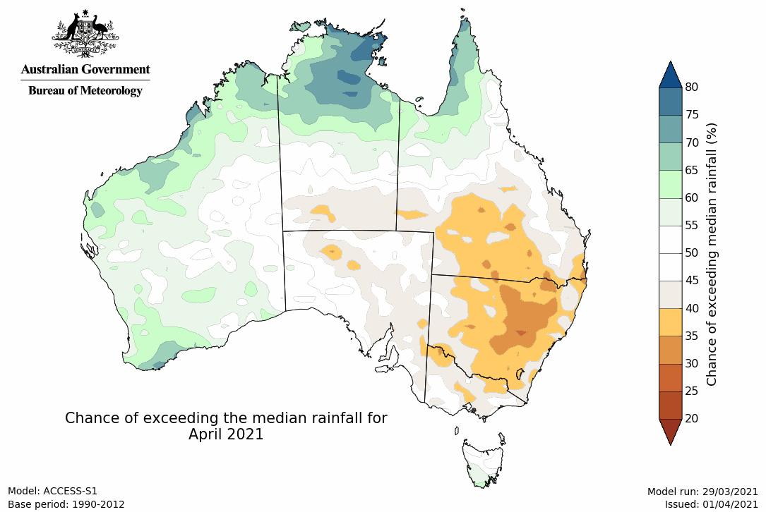
- April to June is likely to be wetter than average (chance of exceeding median is more than 60%) across the far north of Australia, extending from northern WA across to northern Cape York Peninsula. Conversely, a drier than average April to June is likely (chance of exceeding the median is less than 40%) for the southern half of Queensland, inland parts of NSW and Victoria, and far eastern SA.
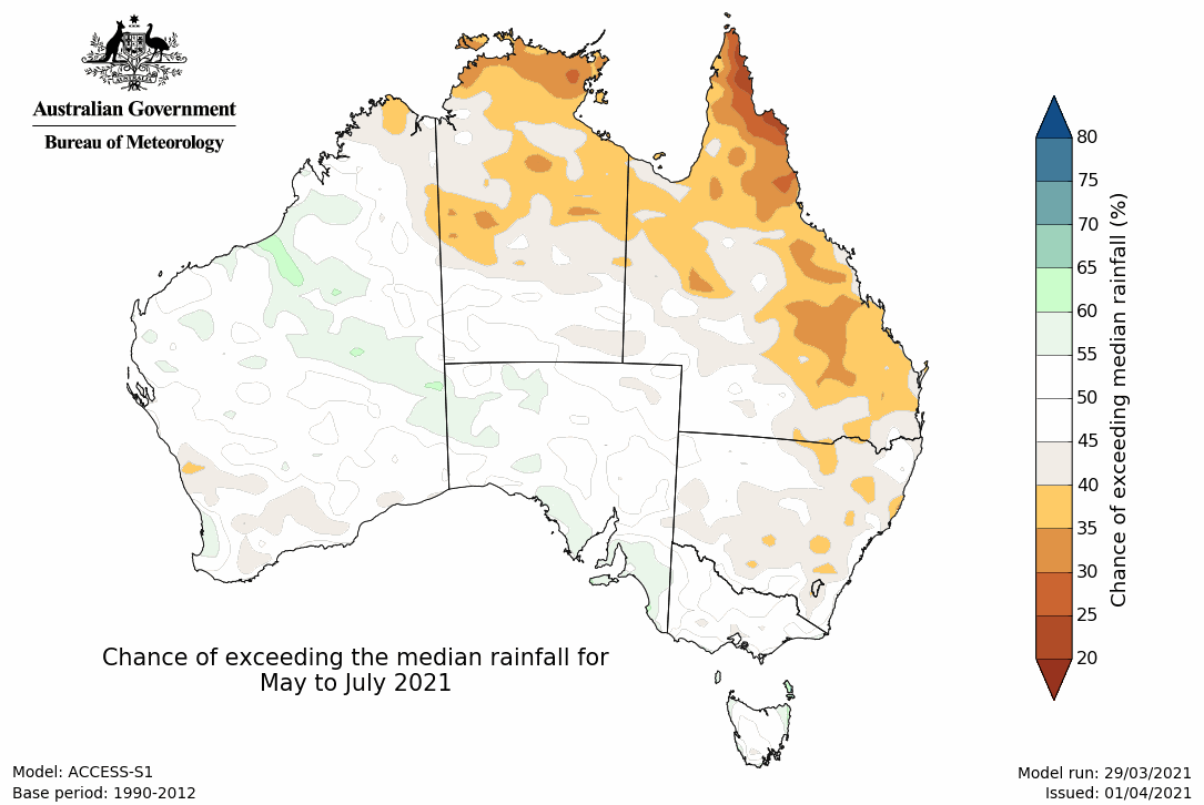
- The three-month wet signal is dominated by the April outlook, with April likely to be wetter than average across a similar area, including northern and south-western parts of WA, the northern NT, and far north Queensland. April is also likely to be drier for parts of southern Queensland, NSW, and northern Victoria. May is likely to be a drier month for large areas of the mainland, with much of south-east Australia having roughly equal chances of a wetter or drier than average month (chances of being wetter than average are close to 50%).
- The week of 5–11 April is likely to be wetter than average (chance of exceeding median is greater than 60%) over south-western and northern WA, the northern half of the NT, and far northern Queensland. Parts of the northern NT are very likely to be wetter than average (greater than 80% chance). A drier than average week is likely for much of eastern Australia.
Rainfall maps
Warmer April–June days and nights for most areas
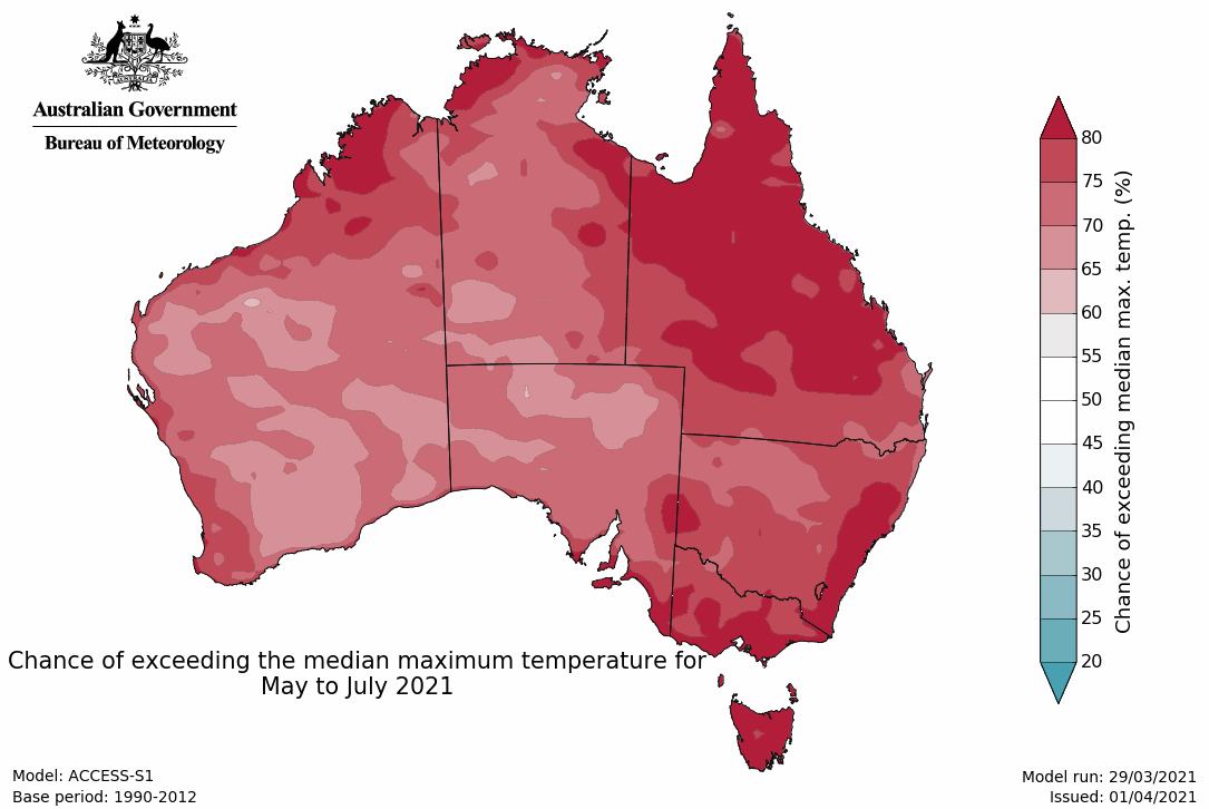
- Maximum temperatures for April to June are likely to be warmer than average for most of Australia (greater than 65% chance), except the NT's Top End where chances of warmer or cooler nights are roughly equal.
- April days show a similar pattern to the three-month outlook, but the Top End of the NT is likely to have cooler April days (chance of exceeding the median is less than 40%) associated with the predicted above median rainfall.
- Minimum temperatures for April to June are likely to be warmer than average for most of Australia (greater than 60% chance) excluding the eastern inland and central Australia, where there are roughly equal chances of a warmer or cooler than average three months. While April shows a similar pattern to the three-month outlook, May's outlook indicates cooler than average nights are likely for parts of inland Queensland and central Australia.
Maximum temperature maps
Minimum temperature maps
Climate influences
- La Niña has faded with most indicators of the El Niño–Southern Oscillation (ENSO) now at neutral levels. Model outlooks, which look at the oceanic component of the ENSO, indicate neutral ENSO conditions for the months ahead. A neutral ENSO state has little influence on Australian climate, and means other climate drivers may influence Australia's weather and climate.
- The Madden–Julian Oscillation (MJO) has moved into the Australian region at moderate strength and is expected to enhance cloudiness and rainfall in far northern Australia over the next week or two. The wetter outlook for April across the tropical north is likely associated with the influence of the MJO in the region.
- The Indian Ocean Dipole (IOD) is currently neutral and forecast to remain so for the remainder of autumn. IOD events are typically unable to form during December to April.
- The Southern Annular Mode (SAM) is likely to be neutral for the coming fortnight. When the SAM is neutral, it has little influence on Australian climate.
- Australia's temperature and rainfall variability are also influenced by global warming caused by human activities. Australia's climate has warmed by around 1.44 °C since 1910, while southern Australia has seen a reduction of 10–20% in cool season (April–October) rainfall in recent decades. There has also been increased rainfall during the northern wet season (October–April), with more high intensity and short duration rainfall events. See State of the Climate for more details.
- The Bureau's climate model uses the physics of our atmosphere, oceans, ice, and land surface combined with millions of observations from satellites and on land and sea. As a result, it incorporates the influence of climate change and natural climate drivers like ENSO, IOD, the MJO, and SAM in its outlooks.


